Hinc itur ad astra
» Star charts, atlases, maps (9/11)
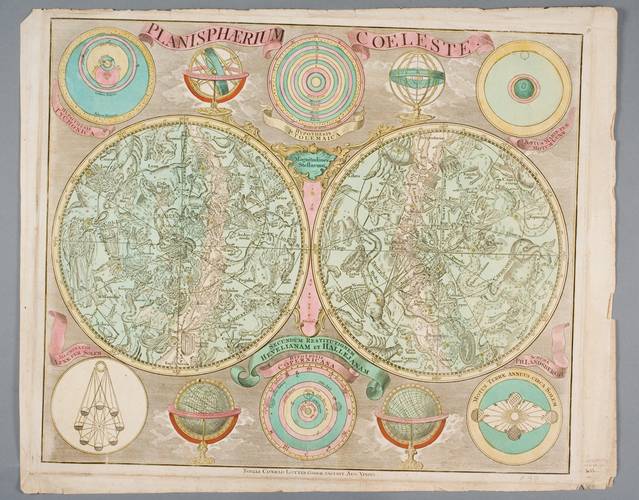
German cartographer, engraver, maps and atlases publisher Tobias Conrad Lotter‘s (1717–1777) Northern and Southern celestial hemispheres star chart Celestial planisphere. The star map is supplemented by T. Brahe‘s (1546–1601), C. Ptolemaeus’s (II c.), M. Copernicus’s (1476–1543) solar system models, several diagrams (sea tides caused by the Moon, Moon phases, the Earth yearly revolution around the Sun), two circular models of the Earth and Sky spheres, illustrations of terrestrial and celestial globes and star magnitude table (magnitude from 1 to 6). Hand coloured.
Planisphere (lat. planum — plane, gr. sphaira — sphere) ora planisphaerium i.e. sky plane – it is a star chart analogue computing instrument to see what stars may be found in the sky at any time or date (in the morning, evening, at night and at a certain hour). On the Planisphere constellations are marked according to months, days and hours. There are 88 constellations in total in it. Planisphere is a perfect sky guide to search for constellations, nebulae, galaxies and planets. Persian astronomer Abū Rayhān al-Bīrūnī (973–1048) was the first who described the instrument in XI c. The star chart was given the name planisphere for the first time by Johann Kepler‘s (1571–1630) son-in-law Jacob Bartsch (1600–1633) in 1624.