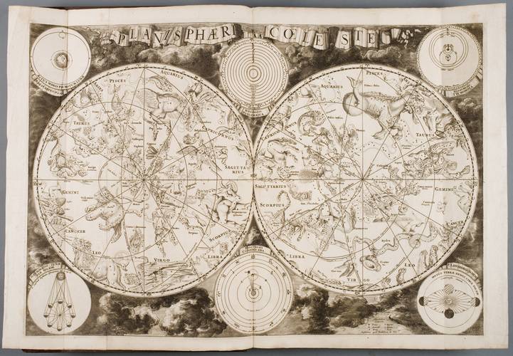
Dutch cartographer, engraver and map publisher Frederic de Witt‘s (1630–1706) Northern and Southern hemisphere star chart engraved about 1700. North and South poles of the sky are depicted in the centre of the charts, constellations are situated around. In the margins there are C. Ptolemaeus’s (II c.), M. Copernicus’s (1476–1543), T. Brahe‘s (1546–1601) solar system models, scheme of the Earth yearly revolution around the Sun, trajectory of the Moon‘s movement.